Using the map
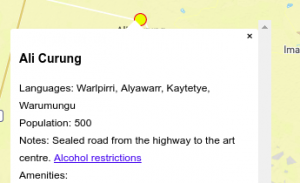
The Travellers’ map of Indigenous art centres indicates the locations of remote art centres with a yellow circle. When you tap the circle, details about the community including a list of amenities, links to community web-sites, and notes on the community are displayed in a small block of text appearing above the map.
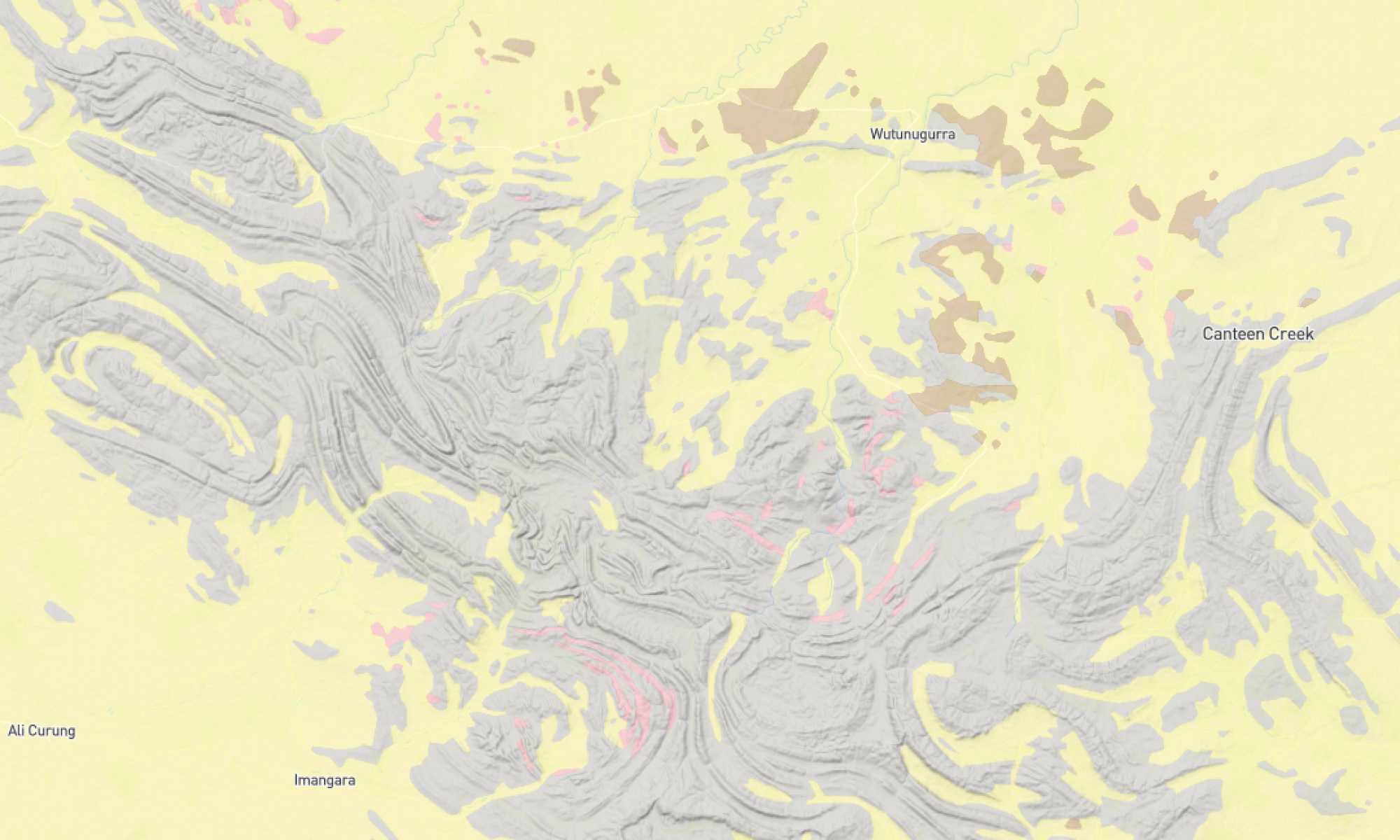
You can zoom into any area of the map to see more detail. As you zoom in, the geography and landscapes of the area are shown in distinctive colours, as shown below.
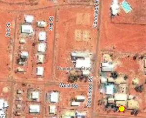
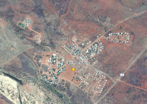
As you zoom in further, satellite imagery is shown. This shows the layout of the community when you are fully zoomed in.
Reliance on the internet
Although the map is internet-based, the most recent views of the map are automatically saved to your computer / tablet / phone, so if you view a community and its pop-up information shortly before travelling, then this part of the map and the pop-up information will most likely be viewable on your phone / tablet / computer while you are travelling without internet. (This is not 100% guaranteed though, so please do not rely on this for navigating.)
Email a view of the map to your friends
If you want to show someone else the view of the map that you have on your screen, simply copy the URL displayed in your browser into an email, and send that off. The recipient will be able to click on the link and see the same view of the map, without installing anything on their computer, tablet or phone.
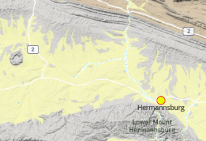
For example, https://trilobite.solutions/indigenous/#14.55/-23.94268/132.78027
will show a view of Hermannsburg.
Indigenous communities
Note that only Indigenous-owned art centres that wish to be on the map are included. Please contact us if you would like your art centre to be added.
Spread the word
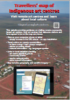
This is a volunteer-run system. If you love using the map, please help us by telling other travellers or friends, posting in social media or forums, writing an article for a magazine or newsletter, creating a link to http://tinyurl.com/artcentres on your web-site, or displaying the poster below.
Open source
This system has been created using free Open Source software – including Ubuntu, Qgis, GIMP, Inkscape, WordPress, Javascript, HTML, CSS, PHP, and Python. Many thanks to the global Open Source community.
Open data
Also thanks to the organisations that have provided data for this map.